Written by Beijing Ovital Software Co.,Ltd.
Get a Compatible APK for PC
| Download | Developer | Rating | Score | Current version | Adult Ranking |
|---|---|---|---|---|---|
| Check for APK → | Beijing Ovital Software Co.,Ltd. | 75 | 4.37333 | 8.4.3 | 4+ |

What is OvitalMap? OvitalMap is a map browser developed by Beijing Ovital Software Co.,Ltd. based on Google API, supporting offline views of Google Map, satellite map and terrain map, as well as voice navigation. It offers a variety of features such as route search, interactive voice navigation, information search, location sharing, communication with friends, track record, elevation data service, and real 3D map.
1. OvitalMap is a map browser developed by Beijing Ovital Software Co.,Ltd. based on Google API, supporting offline views of Google Map, satellite map and terrain map, as well as voice navigation.
2. The API search engine will offer information about your location, roads, and buses, as well as hotels, entertainment, banks, restaurants, supermarkets, gas stations, parking lots, and tourist attractions nearby a certain position.
3. When you are using the system to chat with a friend (just like using QQ or MSN), you can insert a location tag, travel solution, or a map created by yourself.
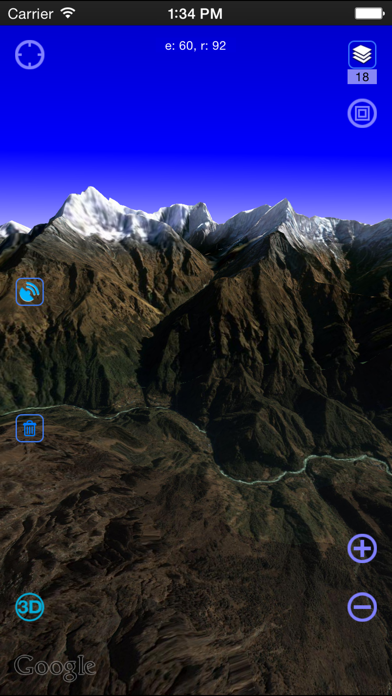
4. We also can direct output the contour line in 10 meters on the satellite map, which helps you directly see the elevation data on satellite map.
5. Elevation data service, the Cloud of Ovitalmap integrate SRTM3 elevation data around the world.
6. Google API offers a search engine to choose the best route for you.
7. There will be voice navigation for the walk or driving route suggested by the system.
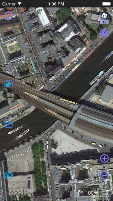
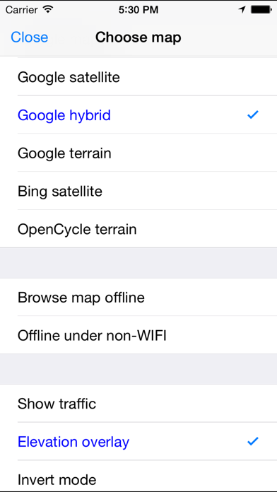
8. At present it supports Google map, Google satellite map and Google terrain map.
9. You can share your location at a certain moment with selected relatives or friends so that they will know your position on the map.
10. The location of friends will be shown on the map dynamically so that you can know where they are and don’t need to worry losing their positions any more.
11. The system can highlight moving tracks of more than one friend with lines of different colors.
12. Liked OvitalMap? here are 5 Navigation apps like Google Maps; Waze Navigation & Live Traffic; ParkMobile - Find Parking; Transit • Subway & Bus Times; SpotHero: #1 Rated Parking App;
Check for compatible PC Apps or Alternatives
| App | Download | Rating | Maker |
|---|---|---|---|
 ovitalmap ovitalmap |
Get App or Alternatives | 75 Reviews 4.37333 |
Beijing Ovital Software Co.,Ltd. |
Select Windows version:
Download and install the OvitalMap app on your Windows 10,8,7 or Mac in 4 simple steps below:
To get OvitalMap on Windows 11, check if there's a native OvitalMap Windows app here » ». If none, follow the steps below:
| Minimum requirements | Recommended |
|---|---|
|
|
OvitalMap On iTunes
| Download | Developer | Rating | Score | Current version | Adult Ranking |
|---|---|---|---|---|---|
| Free On iTunes | Beijing Ovital Software Co.,Ltd. | 75 | 4.37333 | 8.4.3 | 4+ |
Download on Android: Download Android
1. Support for a variety of well-known maps including Google map, Google satellite map, and Google terrain map. The maps can be downloaded for offline applications to save 3G traffic.
2. Route search using Google API to find the best route for travel, either by walk, bus or driving.
3. Interactive voice navigation for the walk or driving route suggested by the system. The location of friends will be shown on the map dynamically so that you can know where they are and don’t need to worry about losing their positions.
4. Information search using the API search engine to offer information about your location, roads, and buses, as well as hotels, entertainment, banks, restaurants, supermarkets, gas stations, parking lots, and tourist attractions nearby a certain position.
5. Location sharing with selected relatives or friends so that they will know your position on the map.
6. Communication with friends using the system to chat and insert a location tag, travel solution, or a map created by yourself. After receiving the insert message, he can have it shown on his map by a simple click.
7. Track record that can be saved and sent to friends.
8. Elevation data service that integrates SRTM3 elevation data around the world. It can direct output the contour line in 10 meters on the satellite map, which helps you directly see the elevation data on the satellite map.
9. Real 3D map that combines the satellite map and elevation data and can show the real terrain of the world.
Note: Continued use of GPS running in the background can dramatically decrease battery life.
- Provides satellite images that can be downloaded and used offline
- Can save offline maps for custom areas and resolutions
- Adapts well to iPad
- Allows users to pick certain icons for favorites
- Language translation bugs can slow down learning the app
- Interface can be confusing and difficult to navigate
- Offline maps may not always save properly
- No documentation in English to help with setup
- Saved images may be removed without explanation
Great functionality, terrible interface
Great while the images remain but they will disappear
Great images, nice features!
Offline maps for anywhere!
 PC Apps